Bathymetric Surveying
Shallow Water Mapping Proficiency
Measurement Sciences Inc. has extensive experience and unmatched capability with bathymetric surveys in Western Canada. For over a decade, MSI has provided bathymetric services using various state of the art sounders and proprietary software to map river and lake beds.
Applications
- Single and Multibeam Bathymetry
- Dual Frequency Sub-Bottom Profiling
- Side Scan
- Sonar Imaging
- Riverbed Change Detection
- Scour Surveys
- Dam Safety Reviews
Projects Inclusive of Service
- Dam Safety Review
- Pine River Riverbed Monitoring
- Storm Pond
- Assessment
Advanced Bathymetric Mapping
Combining single and multibeam echosounding data to create high resolution-underwater surfaces. Applications include, pipeline integrity inspection, hydrotechnical inspection dredge volumes, sinkhole and construction layouts.
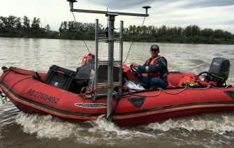
Fleet of watercrafts
MSI has various sized watercraft and propulsion to safely complete a project in any watercourse in Western Canada.
Single and Mulitbeam Echosounders
Multiple sounder options allows MSI to complete a full range of scopes.
Multiple deliverables
Completed deliverables range from topographic maps to interactive 3D models of the surface.


