Pipeline Integrity
Depth of Cover (DOC) Surveys
Measurement Sciences has been surveying and mapping hydro and geotechnical hazards for the pipeline industry for over a decade. MSI has steadily improved our capability and methodology to keep up with the increasing demands of industry and regulators.
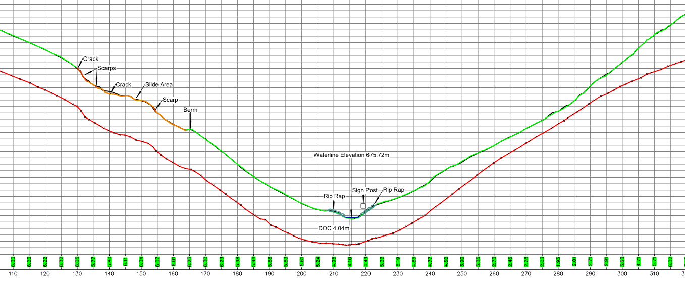
These surveys typically include detailed topographic and hydrographic data collection, accurate three-dimensional pipeline location, and the location of any crucial hazard data. These surveys are also supplemented with high resolution UAV imagery used for visual monitoring.
Accurate comparison plans showing changes in watercourse and bank alignment are generated following repeat surveys. These allow the monitoring of the watercourse and changes in depth of cover, critical information following high flow events.
Applications
- River Crossings
- Slope Integrity Surveys
Projects Inclusive of Service
- Pine River DOC Survey
- Slope Survey
Depth Of Cover Surveys
Combining accurate pipe locating and dense topographic surveys to produce a precise representation of the asset and surrounding environment.
Decade of surveys
MSI has been completed DOC surveys for over a decade. Surveying over 1000 different hazards.
Combination Of Services
Combining LiDAR and bathymetric data allows MSI to create a full 3D model of the hazard and infrasructure.
Accurate Locates
MSI continues to improve pipe location equipment and technique.


